en
Search
 Haná
Haná


The routes of the Cyril and Methodius Trail refer to the cultural roots of the Slavs associated with the arrival of the Thessalonian brothers, Sts. Cyril and Methodius, in Great Moravia. The long-distance routes of the Cyril and Methodius Trail connect the main pilgrimage sites in Poland, the Czech Republic, Slovakia, Austria and Italy.
One of the sections of this international long-distance walking route also runs through the Olomouc Region. It is a marked route from Svatý Kopeček through Olomouc to Velehrad. This route is sometimes called the Archbishop's route because it connects important places - Olomouc, Kroměříž and Velehrad. This section is 113 km long and leads through easy terrain with several really important places to stop and visit.
Route in the Olomouc Region
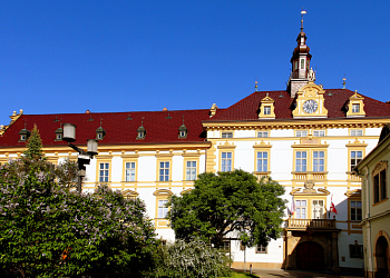
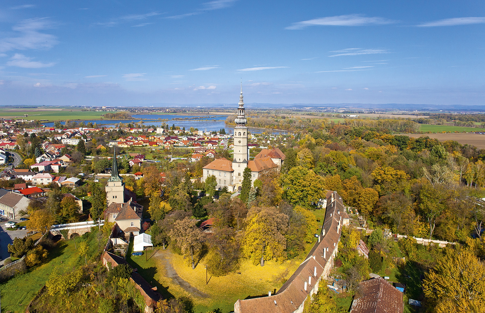
The route starts at one of the most important pilgrimage sites in the Czech Republic - Svatý Kopeček with the Basilica Minor, where in addition to the tour we recommend a visit to the St. From there it continues on to the village of Velká Bystřice, which is famous for its many folk events during the so-called Haná Year, and then we head to the heart of the Haná region - Olomouc. It is recommended that you set aside a longer time to explore Olomouc, not for nothing is it marked in the Lonely Planet guidebook as an undiscovered gem. From Olomouc you will then head south through the Haná countryside with a small detour to the pilgrimage church in Dubu Nad Moravou and then through the picturesque landscape of ponds and lakes to Tovačov, dominated by the Tovačov Castle with its 96-metre high Spanila Tower. In Kojetin, the route ends in the Olomouc Region, but otherwise, of course, it continues on.
Route markings In the Czech and Slovak Republics, dark blue stickers with the white symbol of the Cyril and Methodius Trail are placed on the signposts of the Czech Tourist Club and the Slovak Tourist Club. In the countryside, the Cyril and Methodius trails are marked in both directions www.putujmebezhranic.cz